
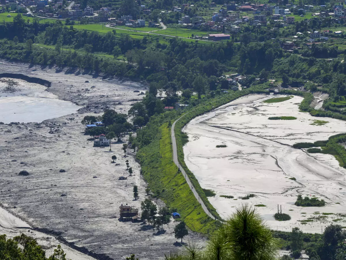
New Delhi, Aug. 31 -- Devastating flash floods and landslides struck the Nepal-Tibet border region on August 26 after a massive chunk of glacier broke away from an altitude of around 5,200 metres and plunged nearly 1,200 metres into the valleys. The resulting surge of ice, rock, mud and water swept through Himalayan valleys, destroying villages, roads, bridges and power stations before reaching a border trading post. Around 800 people have died in Nepal so far, while more than 2,500 people remain missing, including hundreds of tourists and pilgrims.
Rasuwa district was among the worst-hit areas. In Trishuli Bazaar and nearby areas, floodwaters rose to around 60 to 70 feet, submerging riverside markets, schools, colleges and residential settlements. Some buildings were left severely damaged, while others were reduced to piles of rubble. Mud and silt accumulated as high as the upper floors of some two-storey houses. The force of the flood also swept away buses, cars and other vehicles. CCTV footage from Gyirong Port showed a massive torrent of brown mud rushing down from the Nepal side of the border and striking the port building as people tried to flee.
Satellite imagery showed a significant increase in the width of the river following the flooding.
The disaster is believed to have originated at high altitude in the northern part of Langtang Lirung, a mountain near Nepal's Tibetan border. According to satellite data, the rock beneath a glacier collapsed, sending large quantities of ice and rock into the valley. The falling debris blocked the Lhende Khola River and formed a natural dam. Water then accumulated behind the unstable barrier until it eventually broke, sending a powerful torrent of water, mud and stones downstream.
The resulting flow destroyed roads and bridges, devastated settlements and swept away everything in its path. The steep Himalayan terrain further intensified the destruction by accelerating the movement of debris, while narrow valleys channelled the flow towards populated areas. The disaster was initially thought to have been triggered by a magnitude 4.4 earthquake. However, subsequent analysis by the United States Geological Survey found that the seismic energy was generated by the collapse of debris and the ensuing debris flow. Rasuwa, once known as a popular tourist destination, was among the areas that bore the brunt of the disaster. The region was left with destroyed homes, washed-away roads, broken bridges and large piles of debris, making access extremely difficult for rescue and relief teams.
Published by HT Digital Content Services with permission from Millennium Post.