
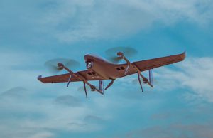
Mumbai, Oct. 27 -- Drones are fast becoming the operational backbone of a new governance model that observes more, responds faster, and leaves a verifiable record, Pradeep Pandurangi notes.
Every monsoon, millions of pilgrims descend on Haridwar for the Kanwar Yatra, and the city buckles. Sanitation systems strain, crowds surge through narrow ghats, and municipal staff scramble to stay ahead of a situation that changes by the hour. No number of ground inspectors can cover it all, so this time the administration looked up and sent drones.During 30 days of Kanwar Yatra from July to August this year, the Haridwar administration ran 170 drone flights tracking crowd density, waste accumulation, waterlogging and illegal encroachments across a city hosting over 45 million pilgrims. More than 8,000 metric tonnes of waste were collected without incident. The administration stayed ahead of events rather than catching up to them.At mass gatherings, the gap between observation and response is itself a governance problem. Drones compress that gap from hours to minutes, and that compression is the difference between a managed event anda crisis.The decision to deploy drones reflects something larger unfolding across India. Drones, or unmanned aerial vehicles (UAVs), are becoming the operational backbone of a new kind of governance, one that observes more, responds faster and leaves a verifiable record. From tiger reserves in Maharashtra to Himalayan survey corridors in Uttarakhand, and now from national highways to the battlefield itself, drones are going where the terrain is unforgiving, and the stakes are high.
Conservation and mappingIn Haliyal, Karnataka, forest officials had spent years losing ground to forest fire. Manual patrols were slow, satellite imagery arrived late, and by the time alerts filtered through, blazes had already taken hold.Hybrid fixed-wing drones changed that arithmetic. On one early mission, an active fire was located within two minutes of take-off,5 km from the base, before it could spread.The two-minute detection window, against the hours that ground or satellite systems routinely require, is enough to change the outcome entirely. Speed of observation is, in this context, equivalent to prevention.Navegaon-Nagzira Tiger Reserve in Maharashtra had a similar fire problem that was anything but accidental. Locals burning tendu (Coromandel ebony) leaves routinely set blazes that tore through the reserve's 274 km perimeter. Five forest personnel were killed in one such fire, and tigers, elephants and other native species fled toward the safety of the villages, raising the spectre of a serious human-wildlife conflict.The officials who stayed back to monitor the situation were trapped, the forest fire raging on one side and their own helplessness to put it out on the other. This is where drones fitted with thermal cameras were flown in, shooting live video and broadcasting it back to the base camp. Drones fitted with megaphones blared live warnings 3 km into surrounding villages, while the offenders who had deliberately set the tendu-leaf fires were apprehended.When seven tigers, including a tigress with three cubs, required relocation because the blazing fires threatened their lives, the operation concluded in eight days without any collateral damage. Forest fire incidents dropped by over 80 per cent. Human-wildlife conflict fell to zero.Drones do not merely detect problems; they dissolve the conditions that produce them. Round-the-clock thermal coverage and live acoustic warnings changed behaviour on both sides of the forest boundary.Tehri-Ghansali in Uttarakhand presents50 sq. km of Himalayan terrain where elevation swings from 600 to 2,600 metres, slopes exceed 65 degrees, and existing elevation models carried errors of 25 to 40 metres, useless for precision work. UAVs equipped with RGB and LiDAR sensors pushed survey throughput to cloud infrastructure for automated processing. Where photogrammetry would have failed against dense canopy, LiDAR cut through, returning bare-earth elevation and capturing micro-topography in narrow valleys. The resulting models now underpin flood modelling, slope risk assessment and infrastructure planning across a region where bad data has historically cost lives.In terrain where the data itself was the obstacle, UAV LiDAR did not merely improve the survey. It made a credible one possible.
Weapons of precisionNowhere has the shift been starker than in defence. During Operation Sindoor, Indian drones and loitering munitions struck designated targets with a precision that older strike systems could not match, working in concert with air defence networks, radar and command centres to protect critical infrastructure and respond to threats in real time.It was a live demonstration of a capability India has been steadily building across categories. Intelligence, surveillance and reconnaissance (ISR) platforms such as TAPAS-BH-201 and Rustom monitor borders and gather intelligence. Loitering munitions like Nagastra circle over a target before striking.Swarm systems, which the premier defence R&D organisation Defence Research and Development Organisation (DRDO) and private manufacturers are racing to perfect, are advancing combat drone capabilities such as air-launched effects (ALE) and fuel-hybrid long-endurance UAVs. Together, these platforms round out the spectrum India is developing for surveillance, strike and sustained combat operations.The shift is as much in economic terms as in military ones. Covering a border with drone technology is simply cost-effective. Round-the-clock patrolling with drones requires fewer systems than an equivalent human deployment and can monitor every inch of an asset without breaking the bank. As conflicts in Ukraine and West Asia have shown, and as illegal border crossings continue to test conventional patrolling models worldwide, drones have moved from a supporting tool to a de facto solution for better governance and improved security.In fact, the battlefield case for drones is inseparable from the economic one. India's Production Linked Incentive (PLI) scheme for drones and drone components carries an approved outlay of '1.2 billion, structured to return a minimum of 8 per cent of revenue to the entity developing the underlying technology. The money reimbursed under the PLI scheme boosts technological development.GST on drones has moved in the same direction, cut from the earlier 18-28 per cent slabs to a uniform 5 per cent in September 2025, a reform that also covers the flight and motion simulators used in pilot training. Between the PLI returns and the tax reset, drones that were once capital-intensive, low-volume defence assets are increasingly priced like a scalable commercial technology.Rewiring drone industryNone of this expansion would have been possible without a regulatory reset. The Drone Rules of 2021, and the amendments that followed in 2022 and 2023, cut the paperwork required to operate a drone in India dramatically. Approval forms fell from 25 to five, and approval requirements from 72 to just four. Fees were delinked from drone size, civilian operations were permitted for drones up to 500 kg, nearly 90 per cent of Indian airspace was opened as a Green Zone for flights up to 400 ft, and the traditional pilot licence gave way to a Remote Pilot Certificate issued by the aviation regulator, Directorate General of Civil Aviation (DGCA), with a passport no longer requiredto fly.The result, visible in the Digital Sky and eGCA platforms that now administer the sector, is a genuine ecosystem: as of February 2026, India counts more than 38,500 registered drones, 39,890 certified remote pilots and 244 approved training organisations. Government programmes have scaled in step. For instance, under the SVAMITVA scheme for land ownership mapping, drone surveys of 328,000 villages, which is 95 per cent of its target, have been completed. Over 27.6 million property cards across 31 states and union territories have been issued. Additionally, under the NAKSHA pilot for urban land mapping, aerial surveys have been completed across 145 of 150 Urban Local Bodies, supporting the creation of GIS-based land records and issuance of legally authentic Urban Property (UrPro) cards.The road infrastructure authority, the National Highways Authority of India (NHAI), now mandates monthly drone footage of every highway project as a permanent, court-admissible record. The applied science centre, Northeast Centre for Technology Application and Reach (NECTAR), deploys disaster-response drones, while the Railway Protection Force (RPF) runs surveillance fleets for floods, landslides and rail security. Under the SwaYaan scheme for drone skill training, 857 capacity-building activities for more than 26,000 participants have been run to date. Meanwhile, a '4 million prize pool is offered under the National Innovation Challenge for Drone Application and Research (NIDAR) initiative to push school-going students to develop autonomous drone applications.Municipal governments have already used drones to identify culprits illegally dumping construction debris and to manage road traffic in Uttarakhand; the same platform could support property tax assessment. Governments across Asia, Africa and Latin America face the same arithmetic: territories too vast, hazards too unpredictable and institutional capacitytoo thinly spread for ground-level oversight to keep pace.What Haridwar, Haliyal, Navegaon-Nagzira and Tehri-Ghansali demonstrate on the ground, Operation Sindoor demonstrates in the air, and the PLI and GST reforms demonstrate on the balance sheet: the operational case for drones in India is no longer in doubt. The scale at which that advantage gets claimed-commercially, industrially and strategically-is the story still being written.
About the author:Pradeep Pandurangi, Group Product Manager at ideaForge Technologies, brings experience across aerospace, advanced structures, mobility and defence sectors, and holds a master's in Aerospace Engineering from TU Delft, the Netherlands.
Published by HT Digital Content Services with permission from Infrastructure Today.